

NEWS
GSS Work Featured on Local Colorado News
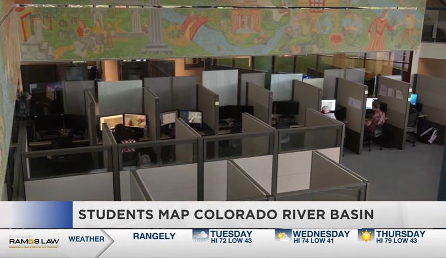
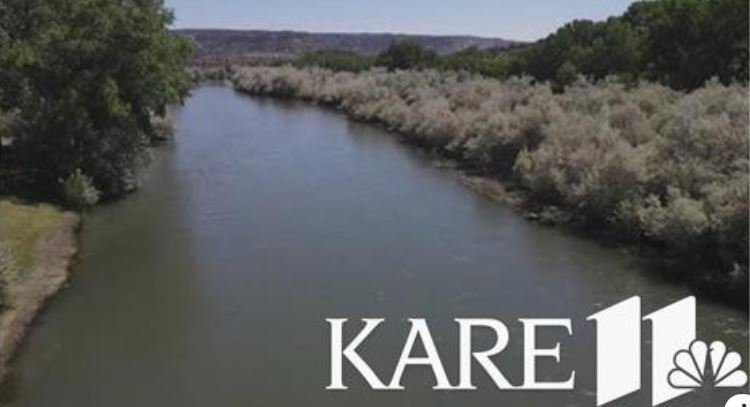
The wetland mapping work of GSS students for Amigos Bravos, a New Mexico non-profit, was recently featured on the local news in Grand Junction, Colorado. See the full story here!
GSS Heads Back to New Mexico
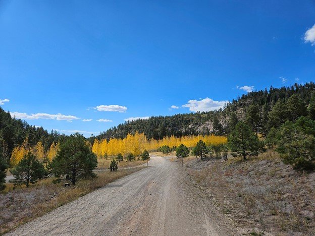
In October, a dedicated team of three from GSS embarked on a week-long fieldwork trip to New Mexico to verify wetland landscape changes across two key project areas. Spanning five days, the trip focused on restoration sites, streams, rivers, and the unique mountain wetland features that characterize the region. The primary goal was to collect data for an updated mapping project of the Canadian River basin and Jemez Mountain areas, which is set to be finalized by the winter of 2025.
The team—Andy Robertson, Zack Ansell, and Isabelle Ostrem—was joined by staff from the New Mexico Environment Department (NMED) and other stakeholders, broadening the scope and expertise involved in the fieldwork. Based in Jemez Springs, the team traveled across the diverse New Mexican landscape, covering an impressive 1,400 miles as they journeyed north to Chama and east to Taos. Along the way, they observed a variety of landscapes, from pristine mountain wetlands to perennial riverine systems.
These collaborative field observations will play a crucial role in the mapping update, ensuring a comprehensive and accurate representation of the region's evolving wetland landscapes. The trip not only provided valuable data on the health of these vital ecosystems but also highlighted the incredible diversity and beauty of New Mexico’s natural environments. With the successful completion of this fieldwork, the team is now one step closer to finalizing the mapping project, which will serve as an important tool for future conservation and restoration efforts in the region.


GSS Visits Great Plains, Missouri River
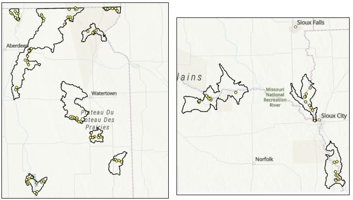
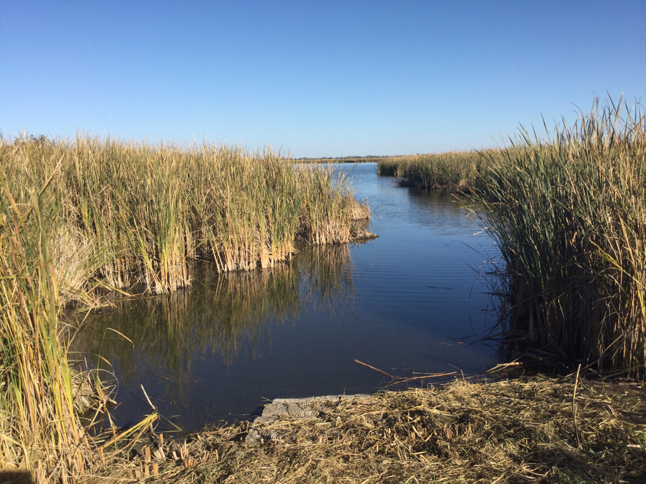
In mid-October, GSS staff Kevin Stark, Nick Lemcke, and Avrey Simonson traveled from northeastern South Dakota, heading south to northern Nebraska, and following the Missouri and Big Sioux Rivers to eastern Iowa. They visited eight different watersheds with U.S. Fish and Wildlife Service Region 3 and 6 NWI coordinators, Nina Hill and Meaghan Lamothe. The team was also joined by Sand Lake USFWS Biologist Jessica Dowler for a day. The field work was part of a wetland mapping update for these Great Plains watersheds associated with NRCS conservation easements. The week prior to this trip, GSS analyst Zack Ansell visited three watersheds between Watertown and Brookings, South Dakota for the same project. Memorable moments from the trip were the Sand Lake National Wild Refuge, which plays a major role for migratory birds associated with the Central Flyway, as well as the Niobrara River Delta. This delta, where the Niobrara flows into the impounded Missouri River, is constantly changing, and has been seeing new sediment islands forming due to the 2019 Niobrara flood.


Robertson & Tadie attend CPI at Notre Dame
GSS Executive Director, Andrew Robertson & SMU Professor, Joe Tadie attended and presented at the Church Properties Initiative Conference held on the University of Notre Dame Campus, September 16-17, 2024.
The event brought together church leaders, real estate practitioners, and academics from around the world, to address the most pressing property-related challenges facing religious landowners and managers.
**Date:** September 16-17, 2024
**Location:** University of Notre Dame, South Bend, IN


Robertson & Kramer present at NTICC in Anchorage, Alaska
GSS Director Andy Robertson recently attended the National Tribal & Indigenous Climate Conference (NTICC) in Anchorage, Alaska. He was accompanied by Larissa Kramer, a GSS employee residing in Anchorage and a member of the Bristol Bay Native Corporation.
Together, they presented on GSS’s work in the Bristol Bay Region, which creates wetland spatial data and highlighting our innovative projects and collaborations with Indigenous communities as well as partnering with Tribal Communities to provide work-integrated learning opportunities for Tribal youth.


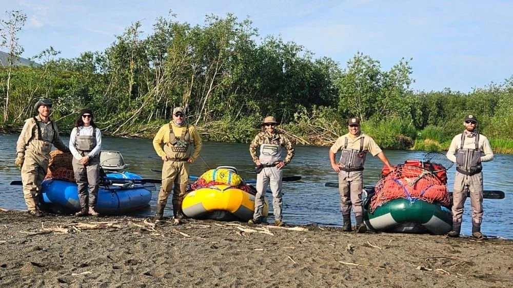
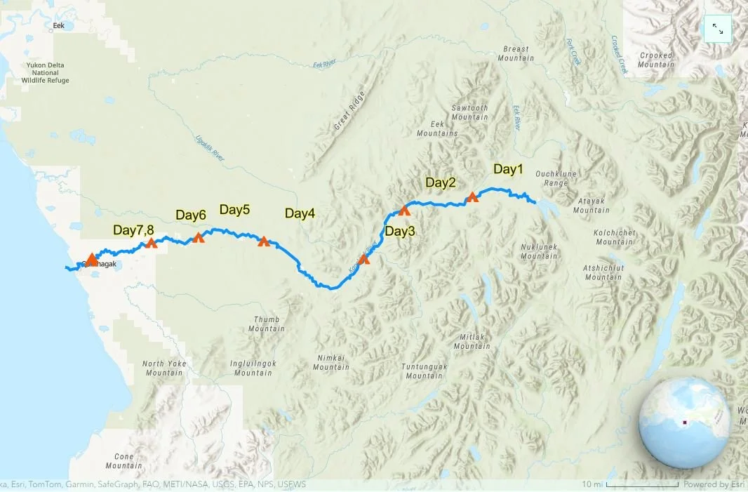
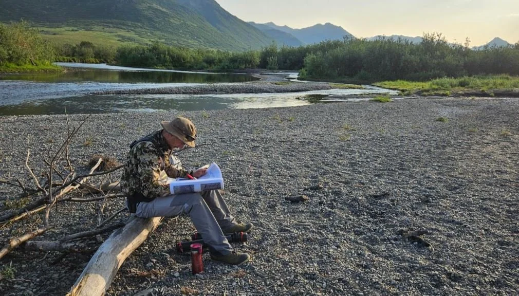
Interagency Collaboration: GSS Floats the Kanektok
In late July, GSS staff members Ben Moonen and Eric Lindquist participated in an interagency river float in the Alaskan wilderness of Togiak National Wildlife Refuge. During the 80-mile float trip on the Kanektok River, Ben and Eric’s goal was to understand and map the river and its surrounding landscapes within the USFWS NWI Mapping standards. For more information and photos about the trip, explore the story map here!
Stark and Lindquist Joined by USFWS in Southern Alaska
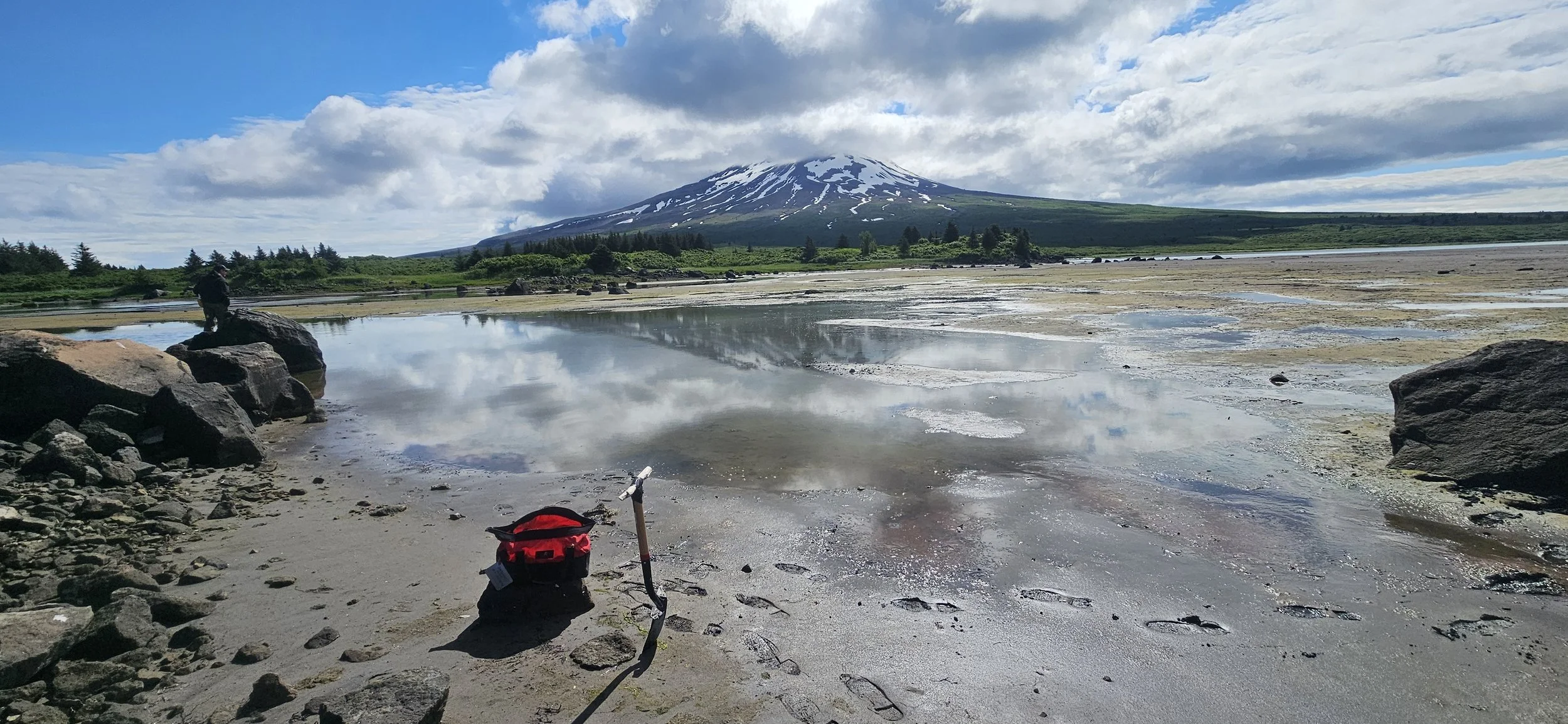
GSS Assistant Director Kevin Stark and Eric Lindquist continued our extensive field season in Alaska, traveling many miles across southern Alaska in mid-July, to collect field data for a project funded by the Exxon Valdez Oil Spill Trustee Council. This project is the second of its kind that GSS has undertaken, stemming from funds allocated after the 1989 Exxon Valdez oil spill.
This season, their field verification work spanned from Valdez and the Copper River Delta, across the Kenai Peninsula, over Cook Inlet, and down to the northern end of Katmai National Park. During their time in Cordova, they were joined by a member of the U.S. Fish and Wildlife Service's National Wetlands Inventory (USFWS NWI).
Additionally, GSS staff had the opportunity to reconnect with two Saint Mary's University alumni, Danielle Braun (‘08) and Katrina Danziger (‘23), who reside in the Kenai and Soldotna areas of the Kenai Peninsula. Photos of their visit are included below.


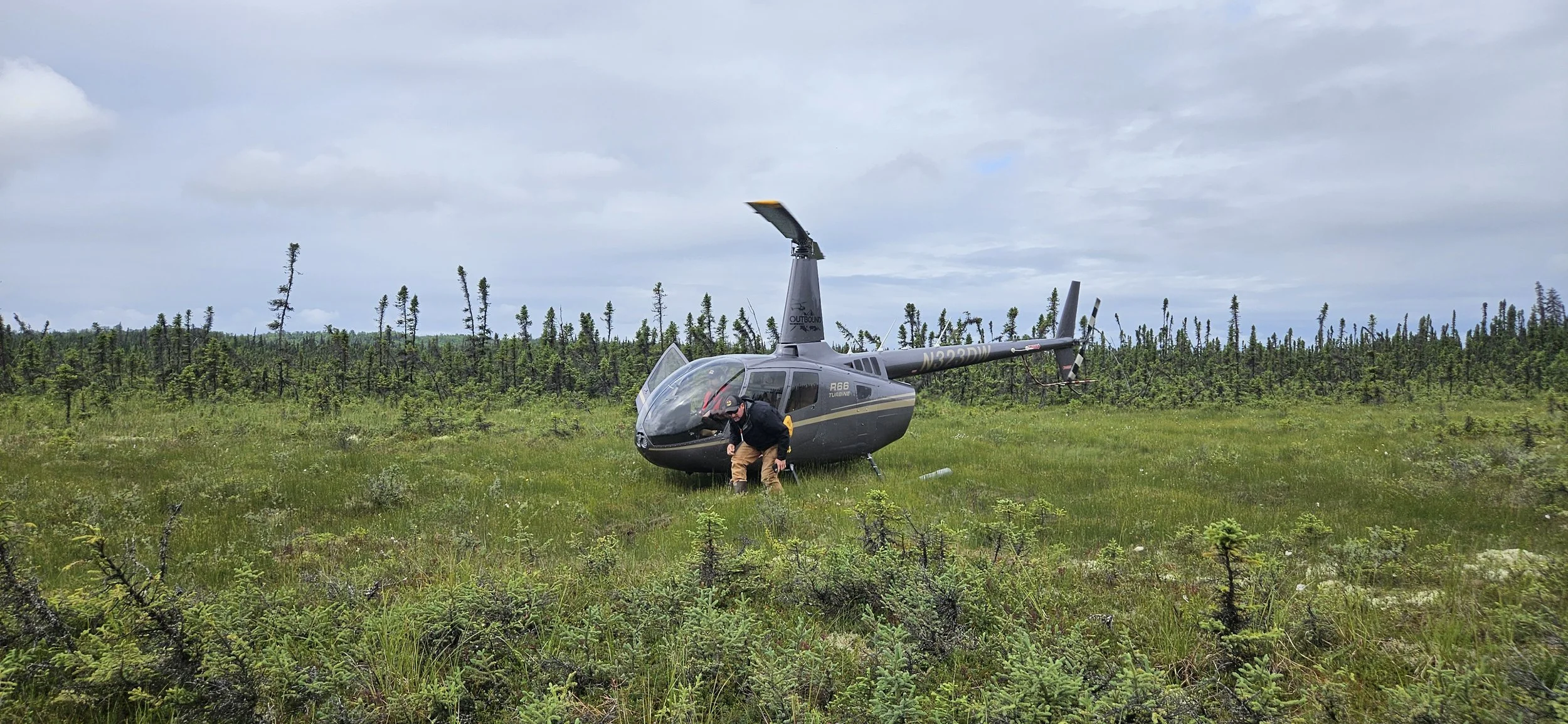


Robertson, Ryan & Lindquist Continue GSS’s Alaska Field Season
In July, Executive Director Andy Robertson, along with staff members Nicole Ryan and Eric Lindquist, continued GSS’s field work in Alaska. The team focused on Katmai National Park and the northwest portion of the Alaska Peninsula. Throughout the Alaska field season, GSS field crews have been correlating satellite imagery and digital mapping of wetlands with on-the-ground observations. The team records plant identification, soil composition, landscape position, and other elements of the landscape, which are then brought back to the teams at Saint Mary's University of Minnesota (SMUMN). This data contributes to the US Fish and Wildlife Service's National Wetlands Inventory (USFWS NWI).
GSS has been involved in updated mapping projects across Alaska and other parts of the US for many years. Staff and students utilize Geographic Information Systems (GIS) software, literature, local knowledge, and other ancillary elements to create data for use and analysis by federal, state, county, and tribal entities across the United States.


GSS Student Intern Assists with Alaska Research
During the month of July, GIS Intern Luke Shappell accompanied a small team from the National Oceanic and Atmospheric Administration (NOAA) on a 28-day research cruise designed to sample and study Pacific cod and gadid (fish in the cod family) populations and their habitats along the Alaskan Peninsula. The NOAA team employed seine nets to drag sites that were rich in kelp and eelgrass (common habitat for gadids) while simultaneously utilizing baited underwater cameras to potentially capture images of young and juvenile cod. Starting in Kodiak and spanning from Sand Point to Seward, the research team sampled over 120 different beaches and cliffs that were located in various bays and islands along the coast. The collected gadids were then further processed with pre-lab work, such as collecting fin samples for genetic testing, that would enable more scientific examination following the voyage. The team's research endeavors, which will end next year (2025), stemmed from a drastic decrease in the Pacific cod populations in 2017, following a dramatic increase of water temperatures in the Gulf of Alaska that was nicknamed “the Blob.” NOAA hopes the data they’ve collected will allow experts to create a predictive model that can help monitor and estimate gadid populations based on measurable variables such as water temperature and salinity.


