Turtle Mountain Band of Chippewa Indians (TMBCI)
Andy Robertson, Executive Director of GeoSpatial Services, recently joined Donna Jacob and Kiah Sagami of Houston Engineering (HEI) to present the final results of a multi-year wetland mapping project for the Turtle Mountain Band of Chippewa Indians (TMBCI).
The presentation focused on the completion of Part 1 of the TMBCI Wetland Program Plan (WPP). This project, supported by an EPA Wetlands Program Development Grant, provides the Tribe with updated geospatial data necessary for informed water resource management and long-term environmental planning.
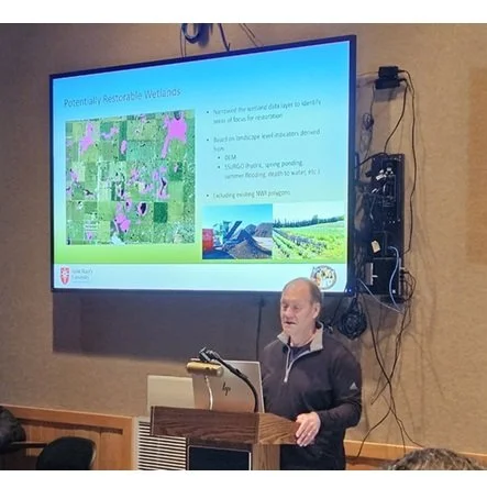
Andy Robertson Speaking at the TMBCI project wrap-up.
Key project deliverables included:
Updated National Wetland Inventory (NWI): A comprehensive re-mapping of wetlands and surface waters within the reservation using current high-resolution imagery.
Hydro-Modified Digital Elevation Models (DEM): Development of an elevation-derived stream network to better understand surface water connectivity and drainage basins.
Functional Assessments: The application of NWIPlus descriptors to characterize the ecological functions of mapped wetlands.
This collaborative effort between GSS, Houston Engineering, and the TMBCI Environmental Office establishes a technical foundation for the Tribe to monitor wetland health and prioritize future restoration efforts.