NEWS
GSS Data Featured in Arizona News
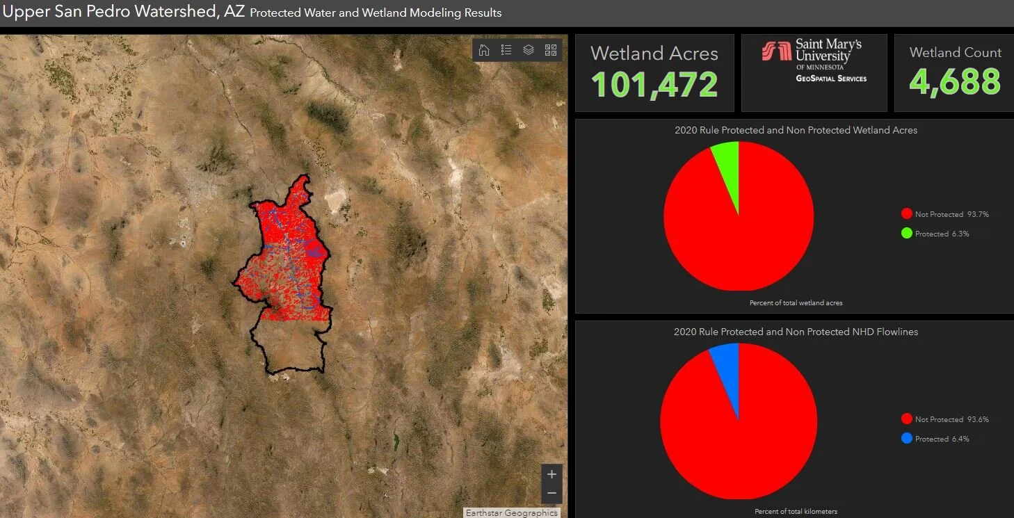
Data from an analysis we completed for the legal advocacy group Earthustice, stemming from our Clean Water Rule work, was featured in an online story for Cronkite News, an Arizona PBS affiliate. The article discusses two court cases filed against the Trump administration’s “Navigable Waters Protection Rule”, which replaces an Obama-era rule that expanded federal Clean Water Act protections to seasonal and other waterways. To read the article, including a link to our analysis for an Arizona watershed (shown below), click here.
GSS SPOTLIGHT!
MICHELE REMER
What is your education and/or professional background?
I am a senior Environmental Biology major with minors in Psychology and Zoology. I worked as a park ranger at Turtle River State Park in Arvilla, North Dakota for a summer and was a science intern at SMUMN the following summer. This past summer was my first at GSS. Currently, I am continuing working at GSS and am also a tutor in the Writing Studio. After graduation, I will be going to Senegal to be a Forestry and Environmental Specialist in the Peace Corps.

What led you to GIS? More specifically, how did you get to Saint Mary's University of Minnesota (SMUMN) in Winona?
I first heard about Saint Mary's through basketball, as I was recruited to play here. Once I visited the campus, I fell in love with the bluffs and the views around Winona, which also fit well with my Environmental Biology major. For that E. Bio major, I needed to take GIS, so the class was my first experience with GIS, which then led me to apply to work at GSS for the summer of 2019.
Explain briefly a project at GSS you've done that contributed to your overall knowledge and educational experience.
I've been working mostly on updating the National Hydrography Dataset (NHD) in Alaska throughout my time at GSS, but one other project that I've grown to enjoy is orthorectifying photographs throughout various watersheds in Alaska. This allowed me to learn some new skills and solve any problems that the software was giving me. It also allowed me to learn a bit more about how governmental projects are carried out, which will be very helpful for any state or federal government jobs that I apply for in the future.
How do you see GIS fitting into your future?
Even if I don't have a job that requires me to use GIS software, working at GSS has provided me with valuable tools for whatever trajectory I decide to take in future careers. Not only have I become a more independent worker and a better problem-solver, but I have also learned more about the flow of freshwater, where it can be found, and how to transition through software and layout updates. All of these lessons will be useful for any environmental biology or sustainability career, and also show that GSS interns are able to adapt with new technology.
Where can we find you outside of GSS?
Outside of GSS, you can find me shooting some baskets in the RAC and hopefully outside once the weather warms up. You can also catch me hiking or canoeing in the canoe that I bought at the big Wenonah Factory sale last semester, once I finally set up the canoe rack. Sadly, those are the places you can find me when I don't have homework, so most of the time I'm actually in the library or the SLC. And since I'm a bit of a book fanatic, you might find me in the library or at home reading for fun and not for a class.
GSS Spotlight!
MATT REID
What is your education and professional background?

I have a Bachelor's degree in environmental science, policy, and management as well as a sustainability studies minor from the University of Minnesota. Currently, I am pursuing a Master's degree in Data Intelligence and GeoAnalytics (DIGA). In my professional career, I've worked as an Elections Administrator with the City of Minneapolis and more recently, with a small environmental startup.
What led you to GIS? More specifically, how did you get to Saint Mary's University of Minnesota (SMUMN) in the Twin Cities?
I felt like I wanted to develop a more technical skillset. I had been exposed to GIS in my undergraduate program as well as in my professional life. I decided I wanted to continue my education and started looking for GIS related programs. Both of my parents attended Saint Mary's, so I had a connection to the university. I also thought the DIGA program looked like a good fit so I applied.
Explain briefly a project at GSS you've done that contributed to your overall knowledge and educational experience.
So I've worked on two projects updating the National Hydrography Dataset in the Arctic National Wildlife Refuge (ANWR) and Kuskokwim areas of Alaska. While working on these projects I've become very comfortable editing data inside the ArcGIS software, interpreting satellite imagery, and I've learned some basic principles of hydrology, understanding how water flows over the landscape. Knowing I'm contributing to an important national database makes this work feel exciting and worthwhile.
How do you see GIS fitting into your future?
One of the great things about GIS is it can be used in almost any field. Personally, I am very interested in energy and sustainability, so I hope to build a career in a similar field. Hopefully, GIS empowers me to become an effective problem-solver and contribute to a more resilient, and sustainable society.
Where can we find you outside of GSS?
Outside of GSS you can find me at the bouldering gym, playing video games, camping, or playing soccer with my elite co-ed rec team. When I'm not studying, of course.
Staff Travel to Florida
In late January, GSS staff members Andy Nadeau and Kathy Allen travelled to Jacksonville, Florida, to kick off our latest NRCA project at Timucuan Ecological & Historic Preserve. The Preserve boundary includes 46,000 acres of natural area and historic sites just northeast of downtown Jacksonville. Much of the natural area is tidal salt marsh with braided creeks, bounded by the St. Johns and Nassau Rivers. Areas and structures within the Preserve also hold historical significance for French, Spanish, and English settlers of America, as well as the region’s indigenous people. The NRCA for Timucuan will assess the condition of park resources such as herpetofauna (amphibians and reptiles), hardwood hammock vegetation communities, fish, oysters, and water quality. During the trip, Andy and Kathy had the opportunity to visit several areas of the preserve, including Cedar Point, Fort Caroline National Memorial, Kingsley Plantation, and Round Marsh in the preserve’s Theodore Roosevelt Area.


GSS Team Receives Employee Recognition Award
In December, the Minnesota NWI Mapping Team was recognized by Saint Mary’s University for their exemplary work and contributions to the University’s educational mission. The award was presented by University President Father Burns at the University’s Christmas dinner. Staff members present to accept the award on behalf of the team were (from left to right in photo below) project leader Dave Rokus, Nick Lemcke, James Loken, Kevin Stark, Jeff Knopf, and Kathy Allen. Congratulations team!

GSS SPOTLIGHT!
ASHLEY TANGANG
What is your education and professional background?
I am a senior pursuing a degree in Biology with a Chemistry minor. I am a 2nd year resident assistant and currently the RA in La Salle Hall. I am also a GSS student intern since April 2019. I plan on going to graduate school to earn a Master's Degree in medical dosimetry.

What led you to GIS? More specifically, how did you get to Saint Mary's University of Minnesota (SMUMN) in Winona?
I come from Cameroon, and I found SMU through my dad. He had a friend who went here and liked it. The university was a good choice because Winona was ranked one of the safest towns at the time of my admission. I knew about GSS from an email sent out by Career Services and I was interested in doing it as a summer job.
Explain briefly a project at GSS you've done that contributed to your overall knowledge and educational experience.
I have worked on the Wyoming wetland mapping project most of my summer and I am currently on the Idaho project. I had no prior knowledge of GIS before these projects. I have come to like it a lot. It was a lot to learn but also very interesting. I have found myself very excited mapping big polygons and reshaping them perfectly. It has also taught me how to step out of my comfort zone to learn.
How do you see GIS fitting into your future?
I know GIS goes beyond mapping wetlands. It can be used for demographic purposes, construction and how far diseases spread. I believe one day I will use my knowledge in GIS in matters of public health.
Where can we find you outside of GSS?
Outside of GSS you will probably find me in the gym every morning. I took on weightlifting a year ago and it has become my favorite hobby. You will also probably find me in the library a lot. I am a science major and it comes with a lot of homework. One thing I like doing is traveling. I travel about 2-3 times a semester so you'll probably catch me around airports.
GSS Receives Commendation
GeoSpatial Services at Saint Mary’s University was one of five partner organizations to receive a Minnesota Governor's Geospatial Commendation award for their work on the recent statewide NWI update project. These awards are given for activities that “exemplify a commitment to coordinated, affordable, reliable and effective use of GIS to improve services within Minnesota.” The updated NWI data will be used across all levels of government, as well as by private industry and non‐profit organizations, as an aid in wetland regulation and management, land use and conservation planning, environmental impact assessment, and natural resource inventories. With over two million polygons in the new dataset, it is one of the largest GIS datasets for Minnesota. Project partners also acknowledged in the commendation include the Minnesota DNR, Minnesota Environment and Natural Resources Trust Fund, the University of Minnesota, and Ducks Unlimited. More information on the project and a full list of SMUMN staff and students involved can be found in the award nomination papers.

Representatives of the project team accepting the award at the GIS/LIS Conference in St. Cloud. GSS representatives were unable to attend.
GSS SPOTLIGHT!
MADDIE BOLLIG
What is your education and professional background?

I am a senior Environmental Biology major with a Zoology minor. I worked as a student worker at Saint Mary’s University of MN Campus Safety for 3 years and as a Camp Counselor/Crew Leader at the Crex Meadows Youth Conservation Camp in Grantsburg, WI for two summers. Currently, I am the Greenhouse Manager for the university and I have been a GSS Student Intern since December 2018. After Saint Mary’s, I plan on going to graduate school to earn my Master’s degree in Conservation or Natural Resources.
What led you to GIS? More specifically, how did you get to Saint Mary's University of Minnesota (SMUMN) in Winona?
Saint Mary’s University has always been a part of my family. I have been visiting SMU for 16 years and this place is like a second home for me. My oldest sister graduated from here in 2007 and my third oldest sister graduated from here in 2015. When it was time for me to choose my school, this university was perfect because I was looking for a small school and the surrounding environment is perfect for my major. I have always known that I would be an Environmental Major, as well. The environment has always been a big part of my life and who I am.
Explain briefly a project at GSS you've done that contributed to your overall knowledge and educational experience.
I have worked on the GSS BLM Wyoming Project for most of my time at GSS. The experience I have gained on this project has benefited me immensely. Currently, I use this experience to assist me with my senior thesis. I am looking at the relationship between needle grass, a native species, and spotted knapweed, an invasive species, in the Crex Meadows State Wildlife Area. In this project I have used my experience gained at GSS to map the locations of these species and have used the tools I have learned to analyze these species’ relationships with each other and their surrounding environments. I am hoping this work will give the scientific community more insight on the impacts of invasive species. It would not have been possible without my experiences at GSS.
How do you see GIS fitting into your future?
I see GIS fitting into many aspects in my future. In the technology age, many organizations in environmental science use GIS in their research and management plans. They use it so frequently that they are now requiring new hires to have this experience. I have a feeling I will be using my acquired skills from this position frequently.
Where can we find you outside of GSS?
Outside of GSS I am involved in many things. On top of my education and work, I am involved in Cross Country, Indoor/Outdoor Track and Field, and Concert Choir. I also play piano and guitar on the side. I usually stay very busy! So the answer to this question is running on a trail somewhere or at Yons.
GSS SPOTLIGHT!
SHAUNA FRAHM
What is your education and professional background?
Before starting at Saint Mary’s, I took a few community college general education classes. This allowed me to jump right into the core curriculum of my original intended major- music industry. Not wishing to be a starving artist, I switched to a management major with a music minor. Now that I’ve completed my bachelor’s degree, I still don’t really know what I want to do with myself- so I decided to jump into a new degree! Currently, I have completed half of my MBA/Project Management Specialization courses.

What led you to GIS? More specifically, how did you get to Saint Mary's University of Minnesota (SMUMN) in Winona?
I grew up in Dodge, Wisconsin, Just “over the river and through the woods” to Saint Mary’s University, so the school had always been in the back of my mind. Attending was a bit of a last minute decision- I finished high school a year early and hadn’t applied to anywhere until May of high school graduation. SMU accepted my application, and with just over a month remaining until classes started, I enrolled. It wasn’t until my senior year at Saint Mary’s that I heard about GSS through an email- some company was looking for student workers. It was no “ah-ha!” moment for me, more like a “why not give it a try?” I had briefly learned about geographic information systems as they relate to business functions- so my curiosity got the better of me and I sent in an application. I guess the rest is history.
Explain briefly a project at GSS you've done that contributed to your overall knowledge and educational experience.
The main project I have been working on is the Wyoming Bureau of Land Management contract. With no real experience prior to this, it was a lot of information to take on. Then when my higher-ups approached me and asked if I wanted to help lead a team of summer workers, I said yes. The biggest learning factor for me was going from being the person asking all the questions to being the person who is supposed to answer the questions. When people are depending on you for answers, you learn the answers a lot faster… or in my case, get a lot better at asking others for help. It’s been a great experience learning something totally new.
How do you see GIS fitting into your future?
GIS is a very powerful project management tool. Beyond just a topographical application, GIS can be used to scope out essential criteria for business strategic locations. Finding the right area based on demographic information such as income, education, population, proximity to resource suppliers, and so many other criteria can be achieved in a timely manner using GIS tools. Hopefully one day I can be the person with the knowledge and authority to make such business decisions.
Where can we find you outside of GSS?
Outside of GSS or the quiet study areas used for homework completion, there’s no safe bet where you will find me. I'm rather spontaneous and enjoy making crazy last minute plans. I like to try/do a bit of everything. I do enjoy traveling, hiking, gardening, hunting, skating, and rocking out to 5FDP or A7X in my car. Besides for the last of that list, I’m pretty much trying or doing something new every weekend. Ever been skydiving? Me neither, but that’s next on the list!
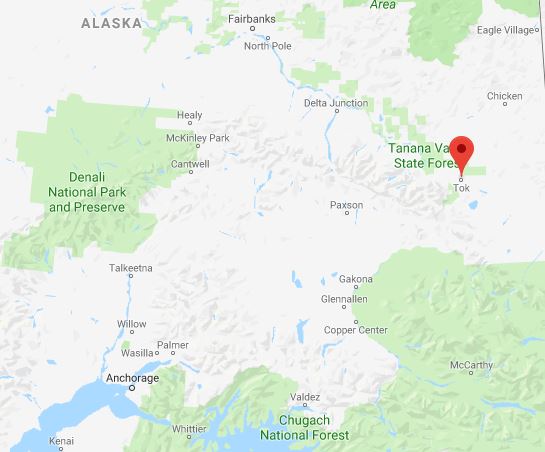
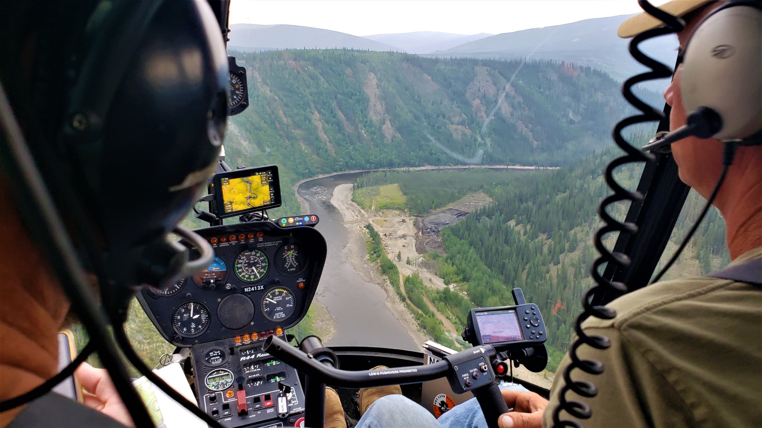
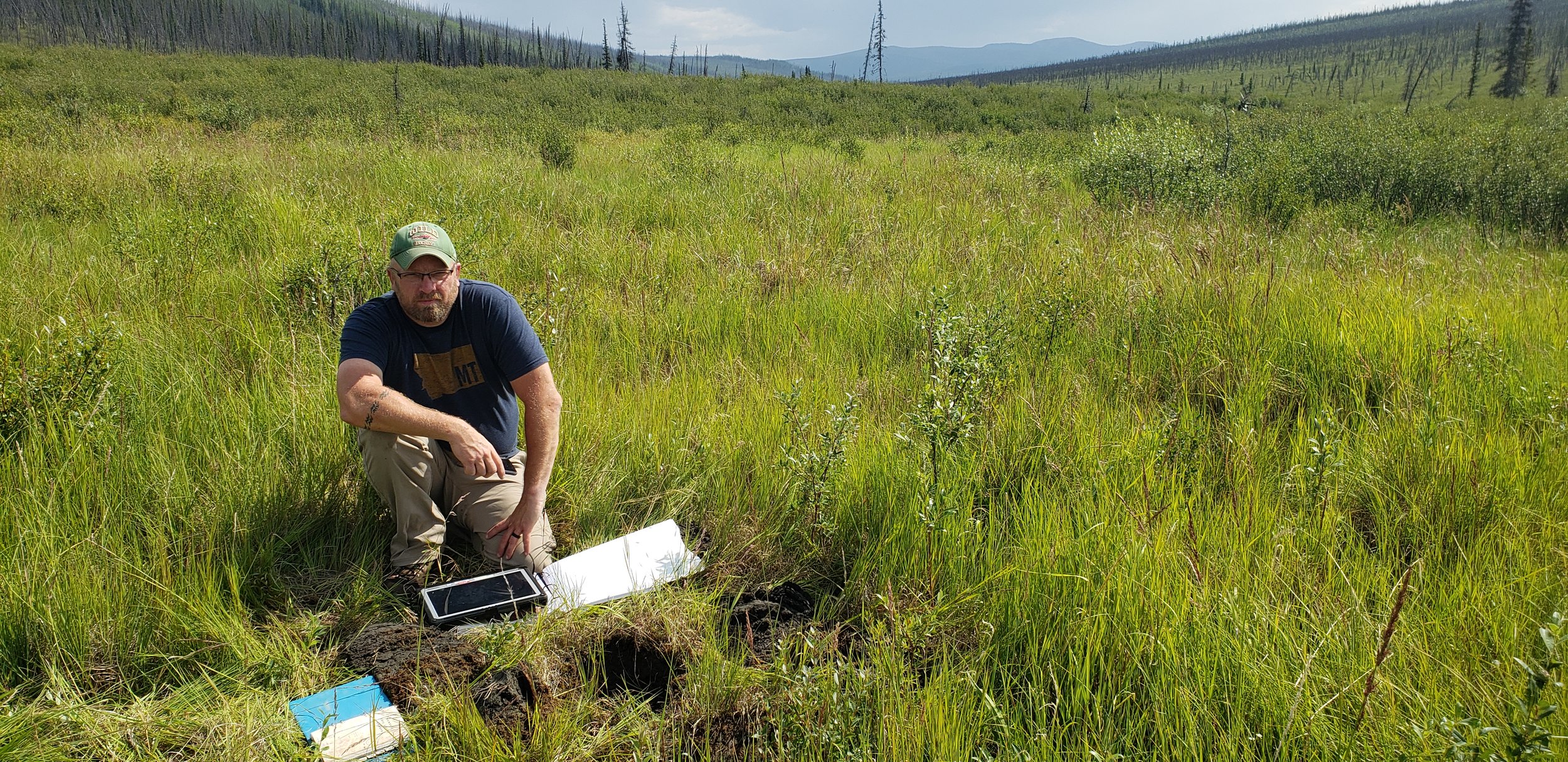
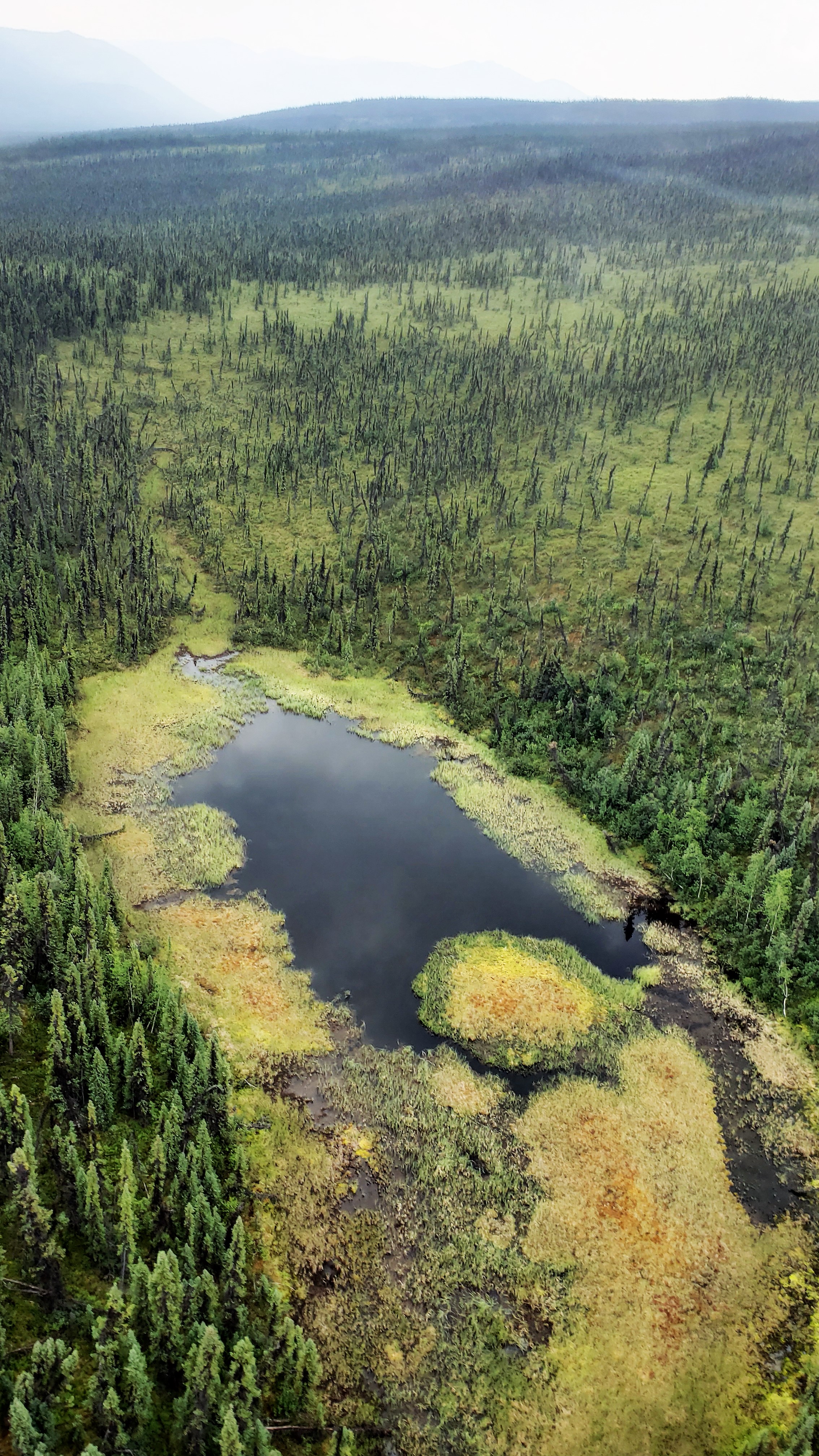
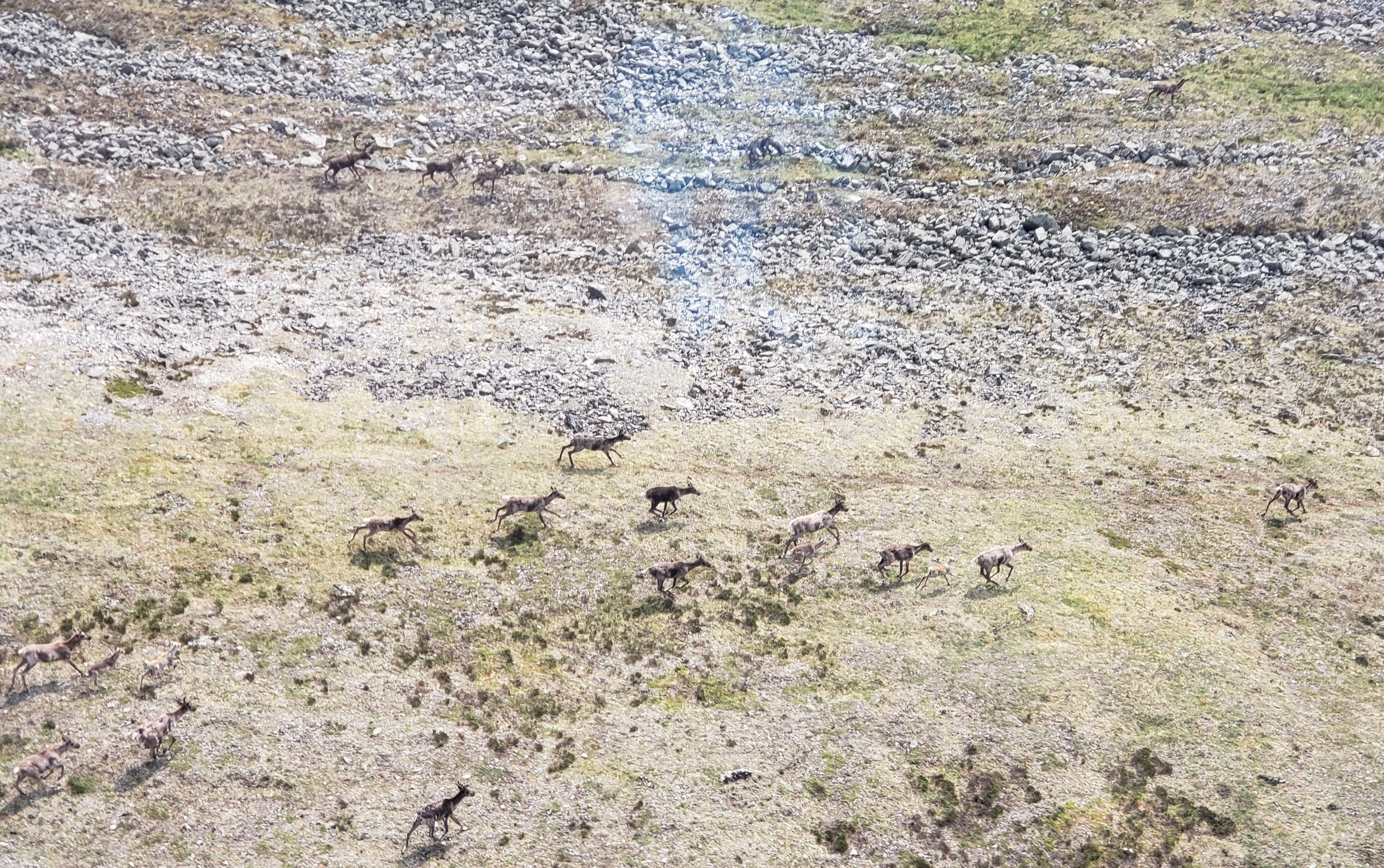
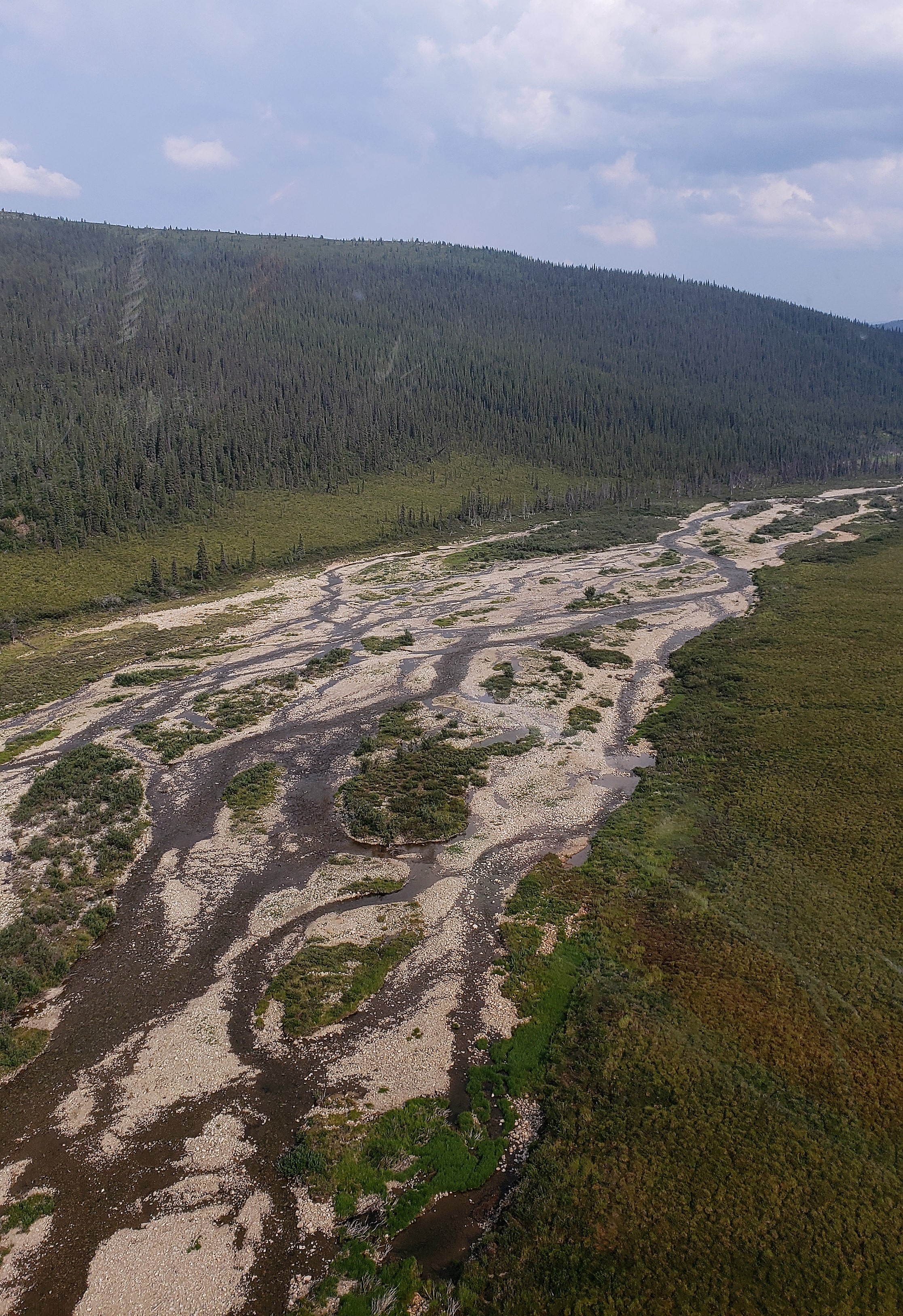
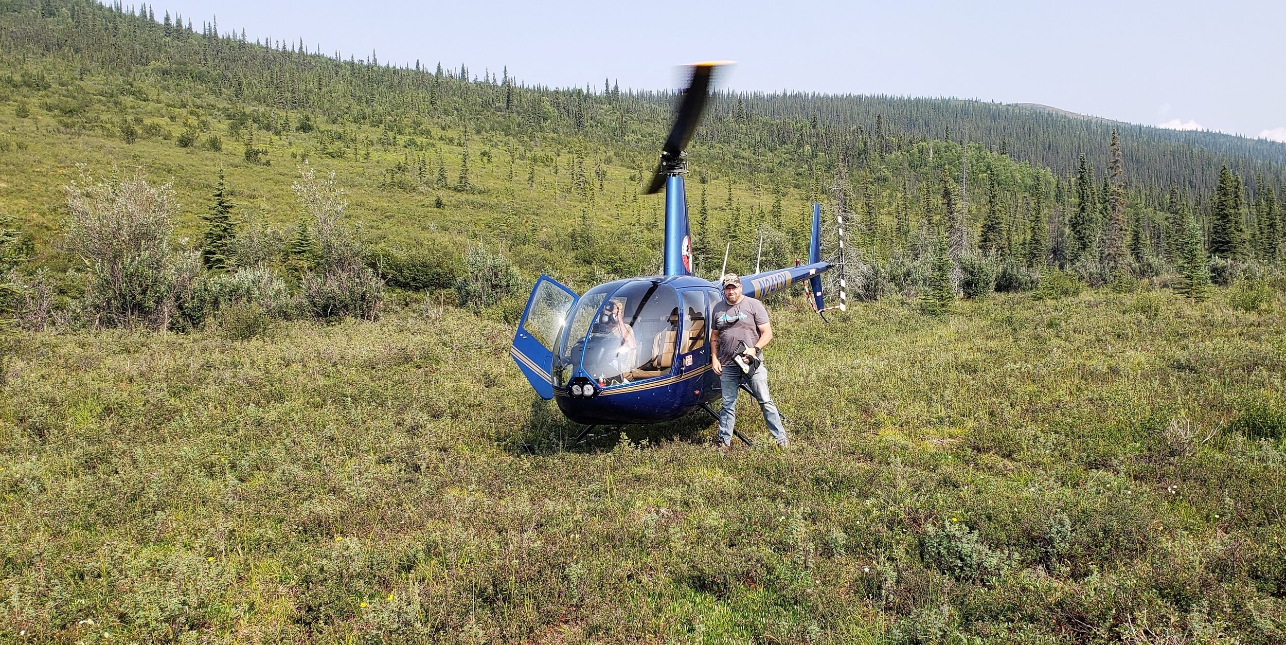
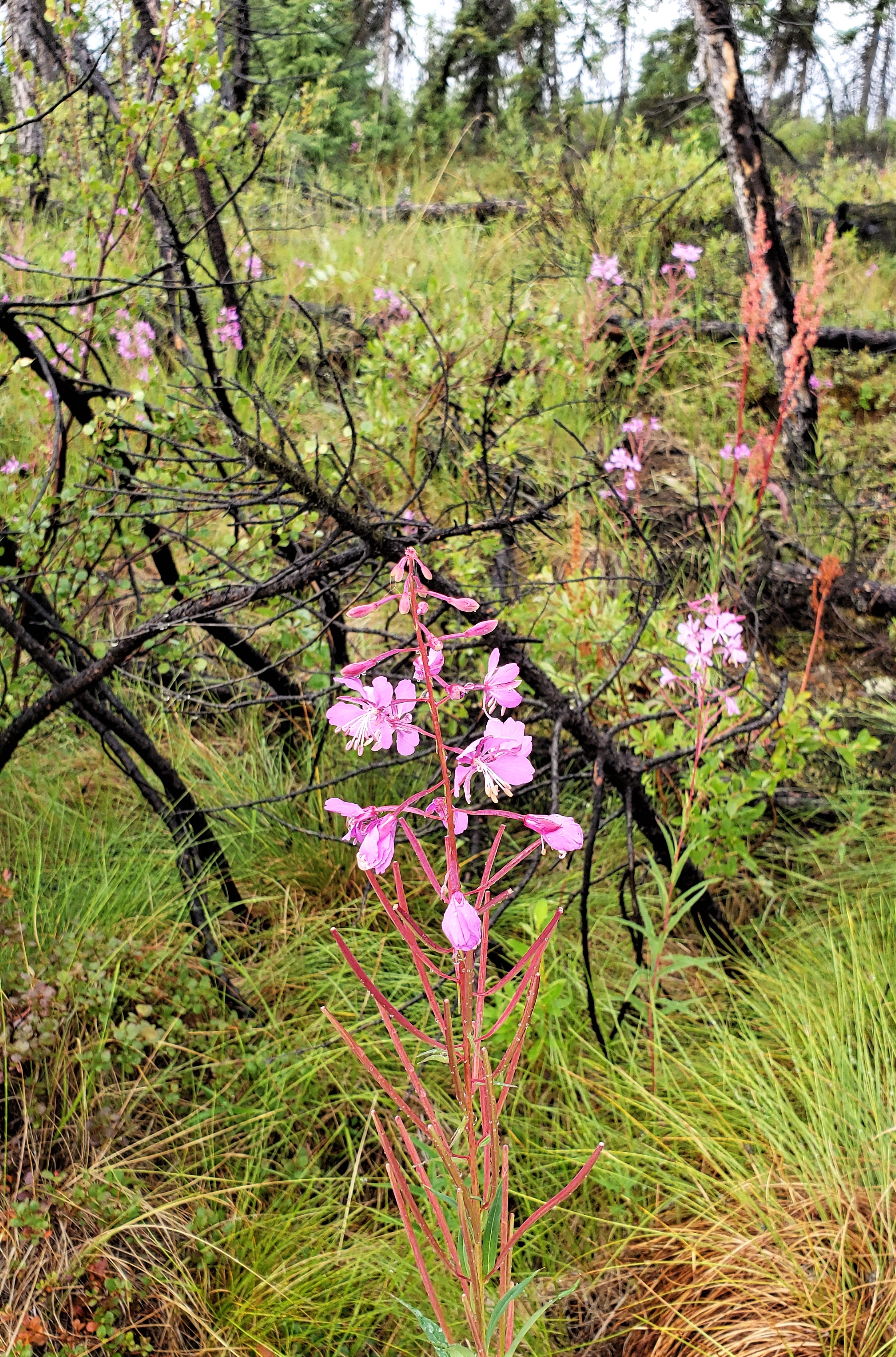
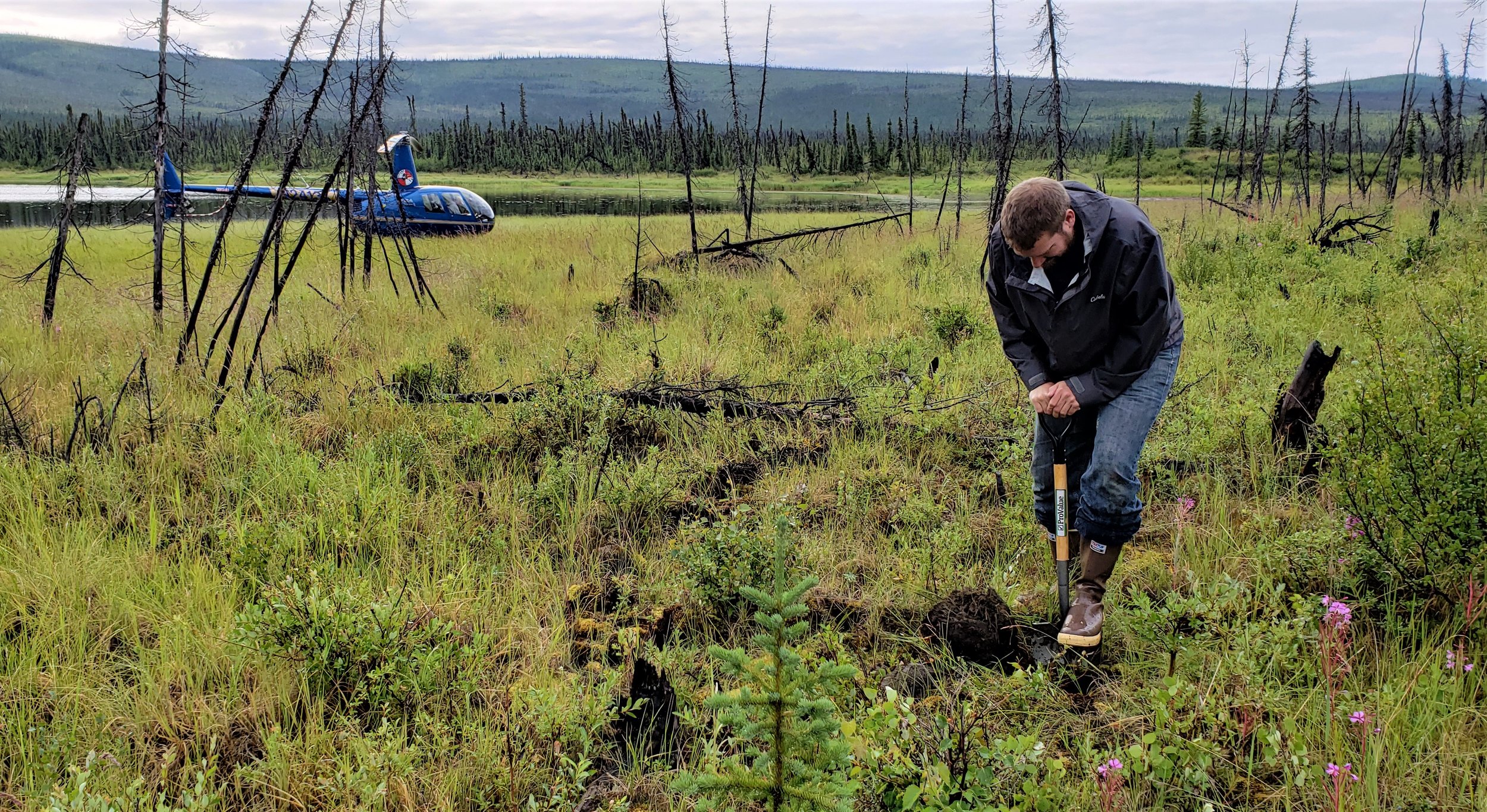
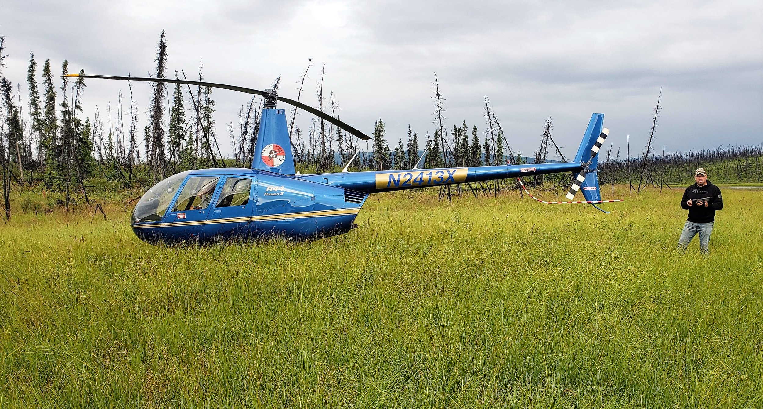
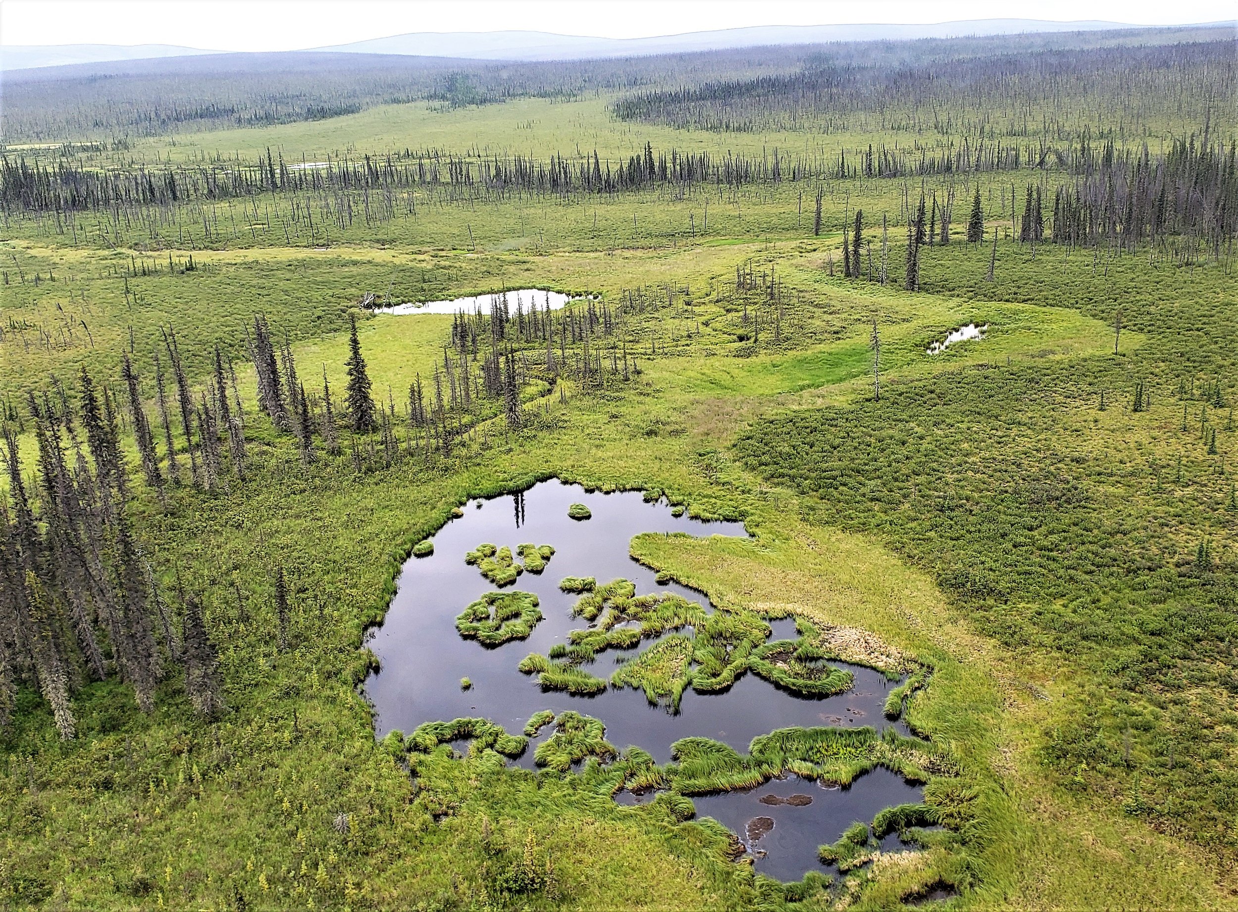
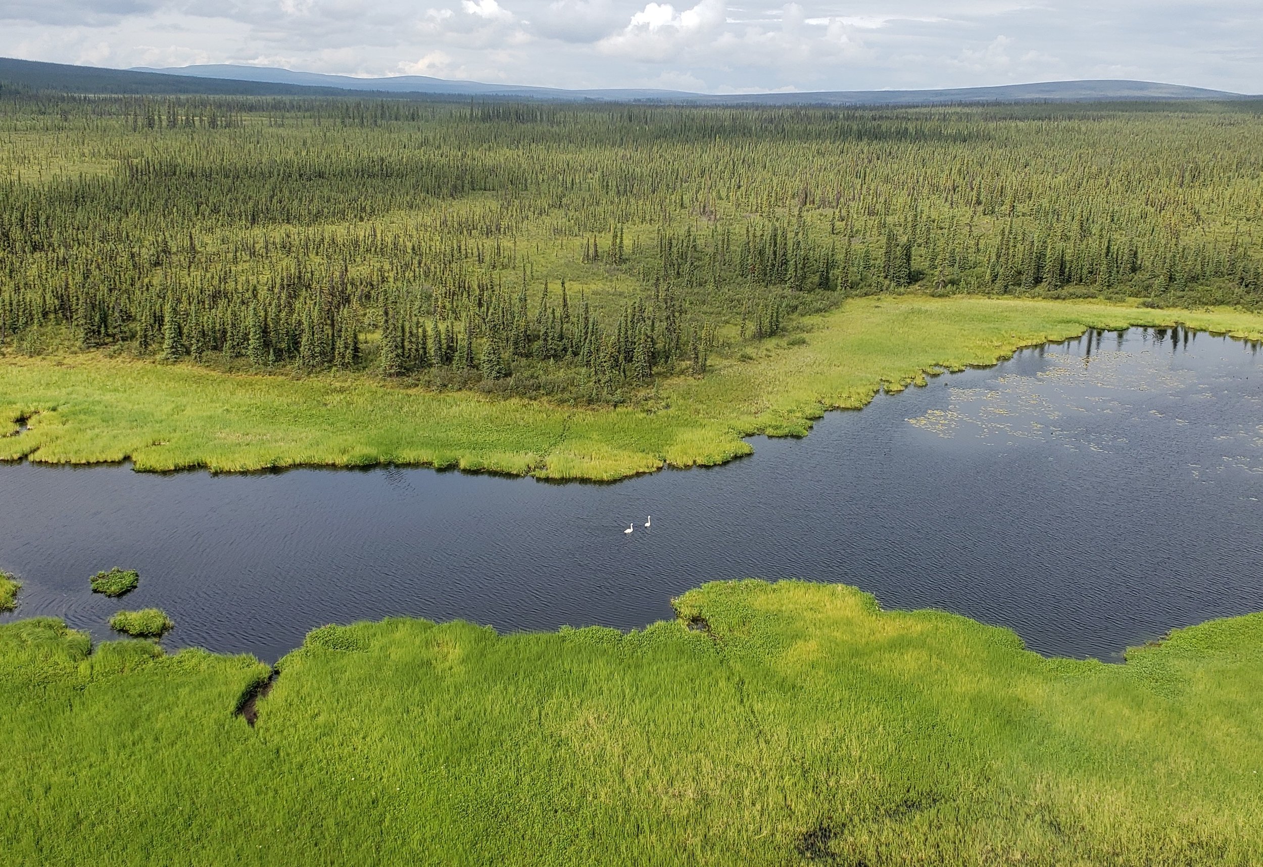
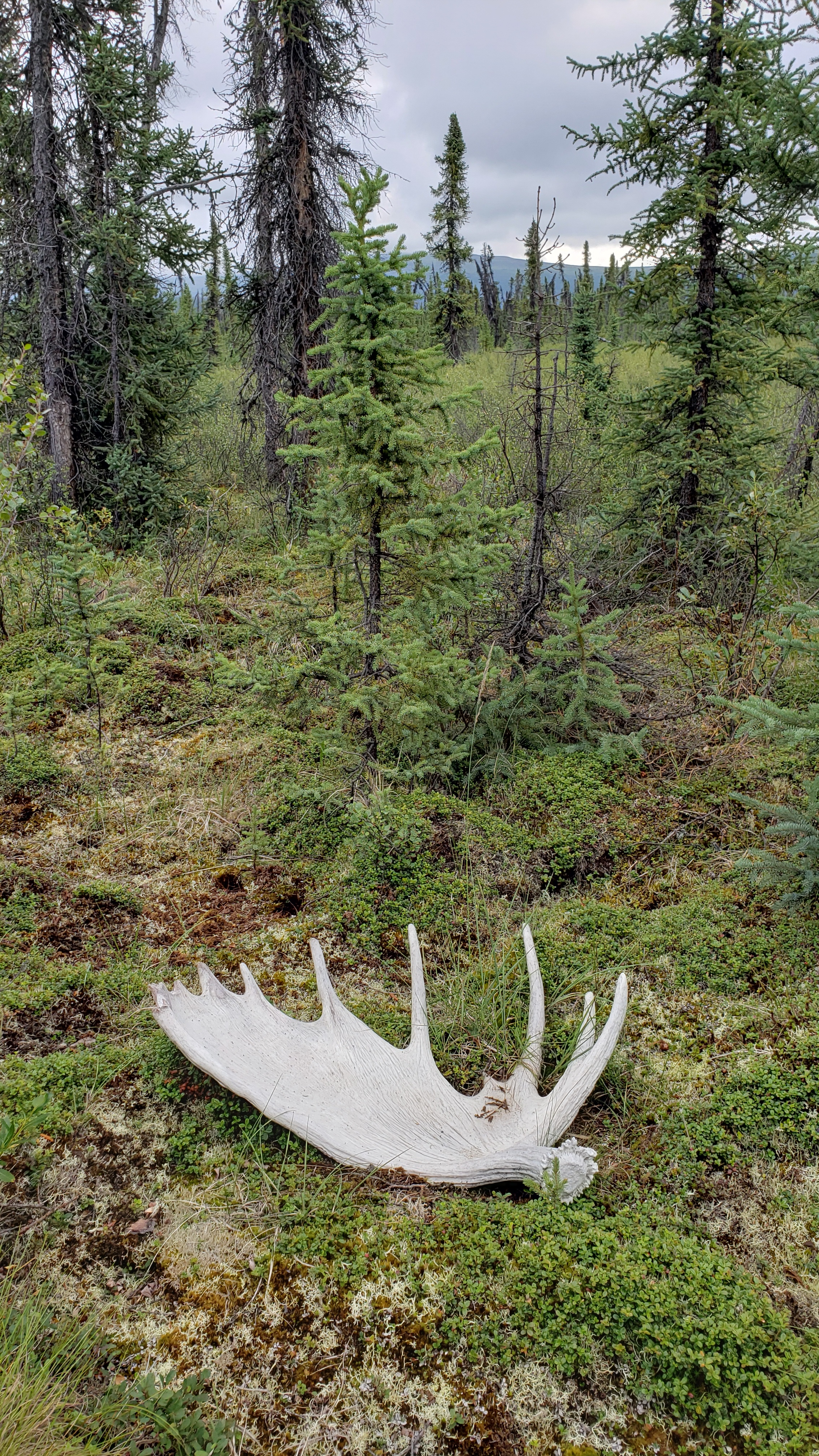
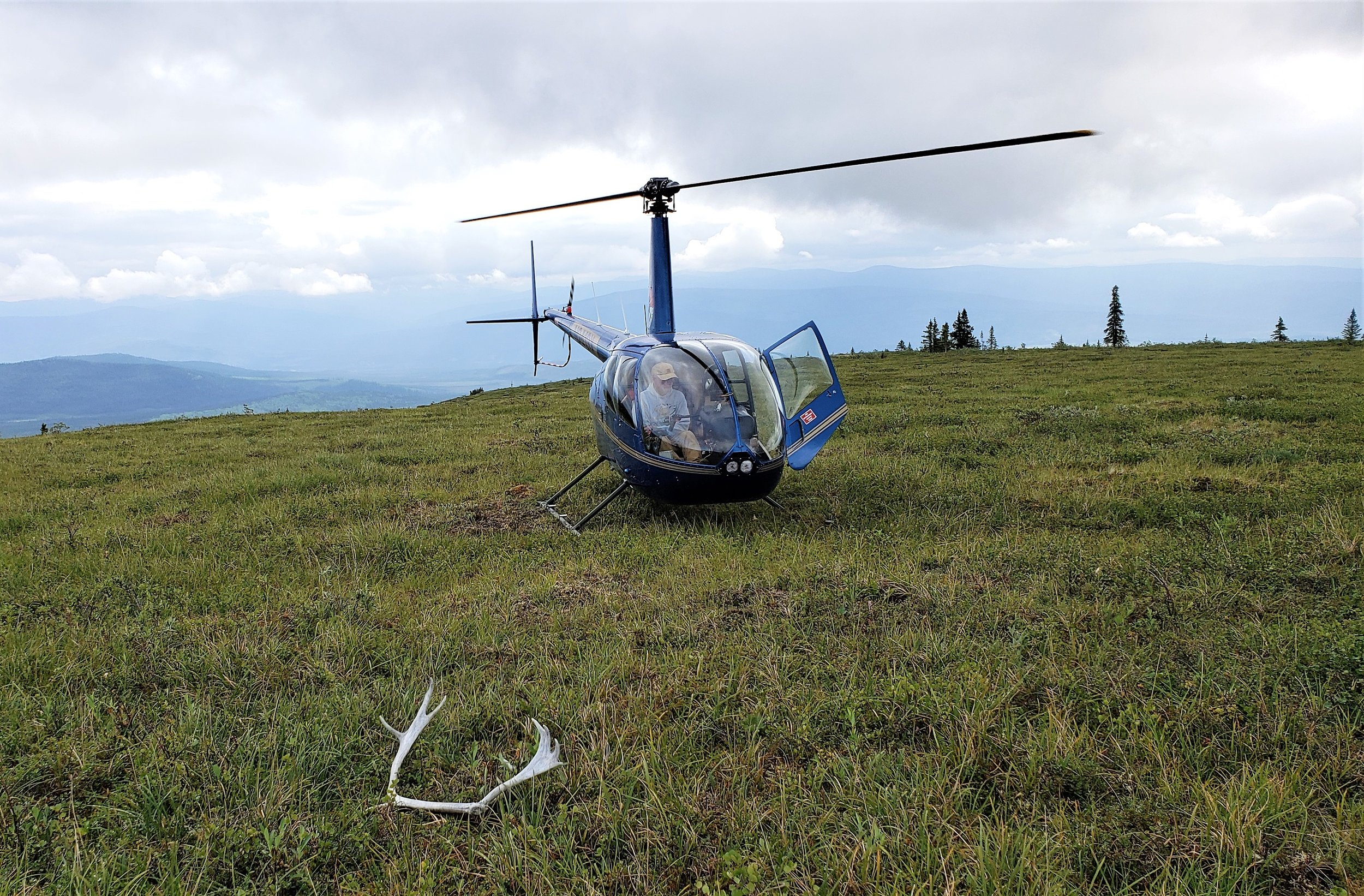
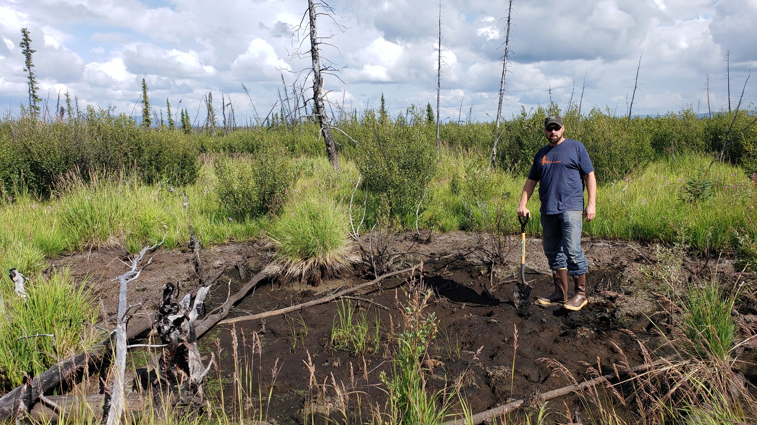
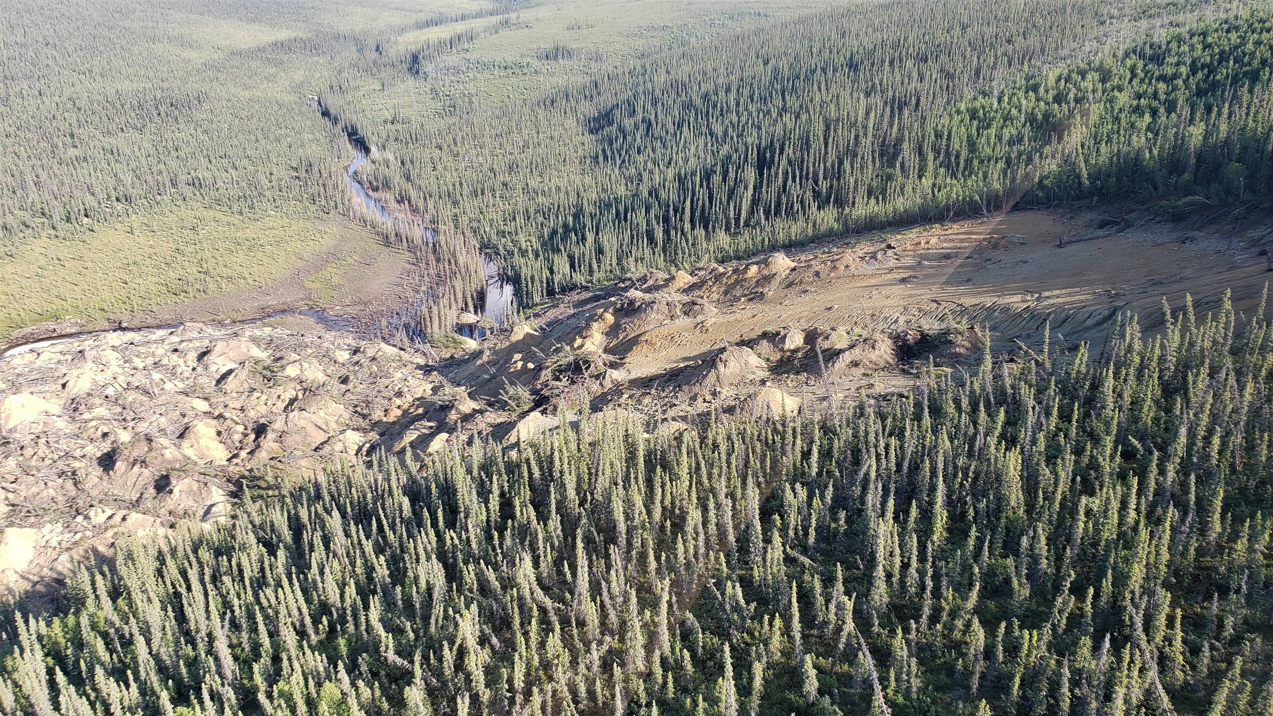
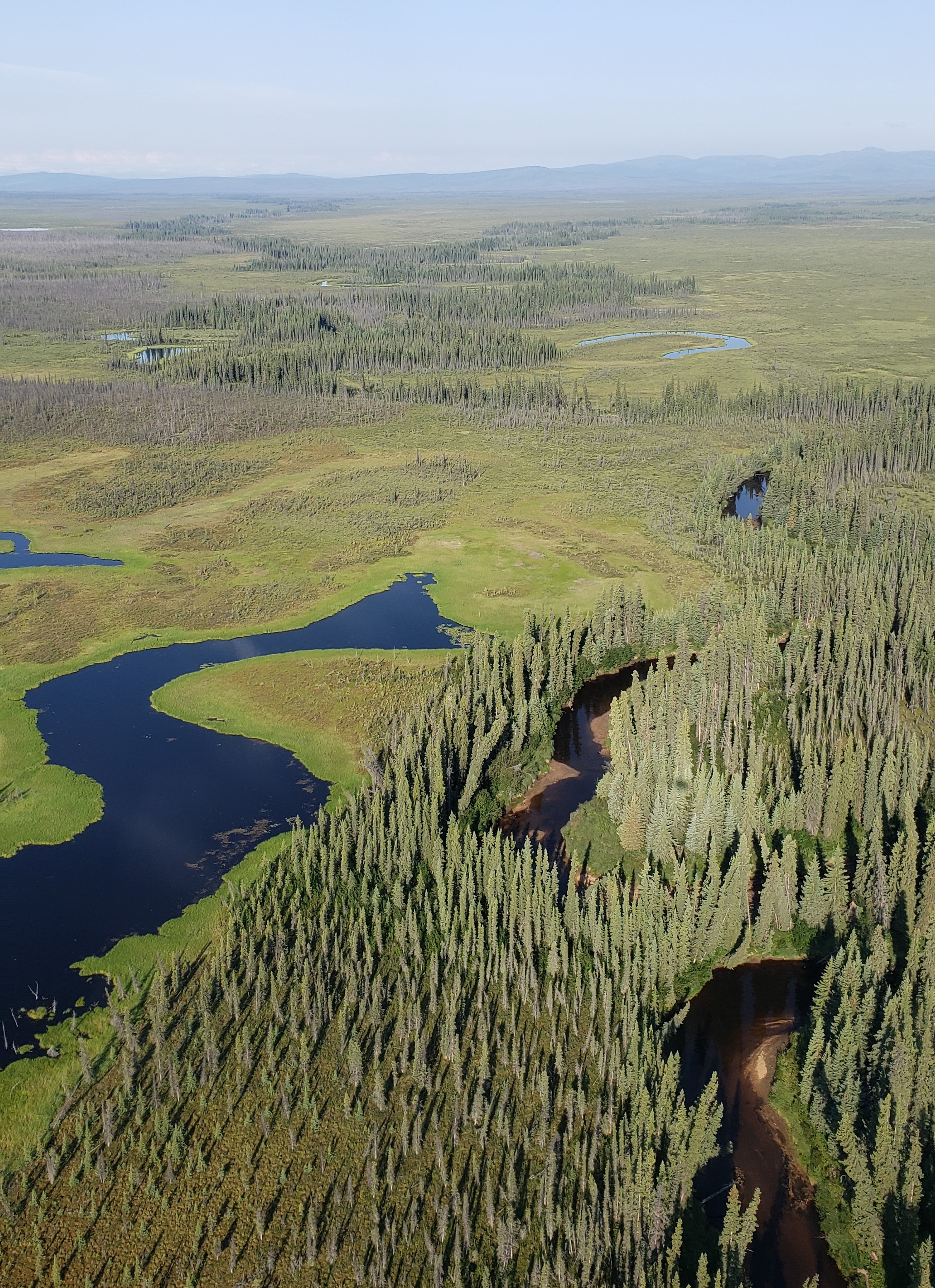
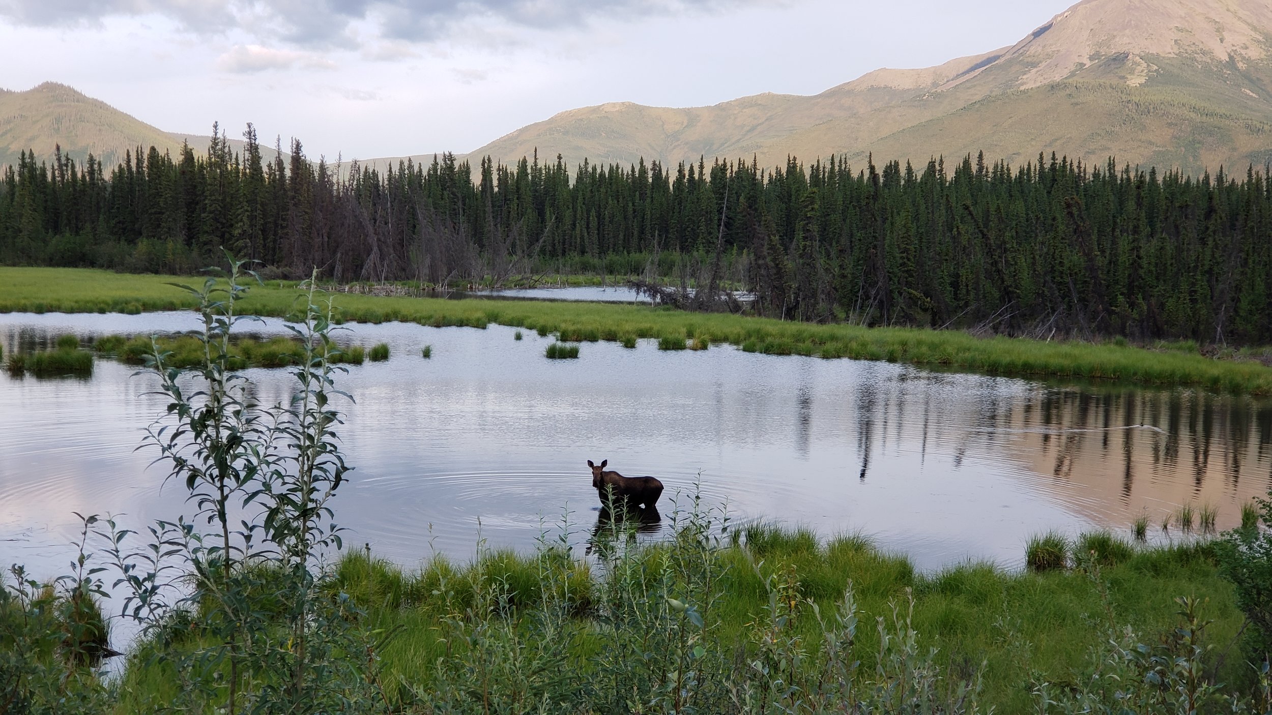
BLM Field Work Rolls On
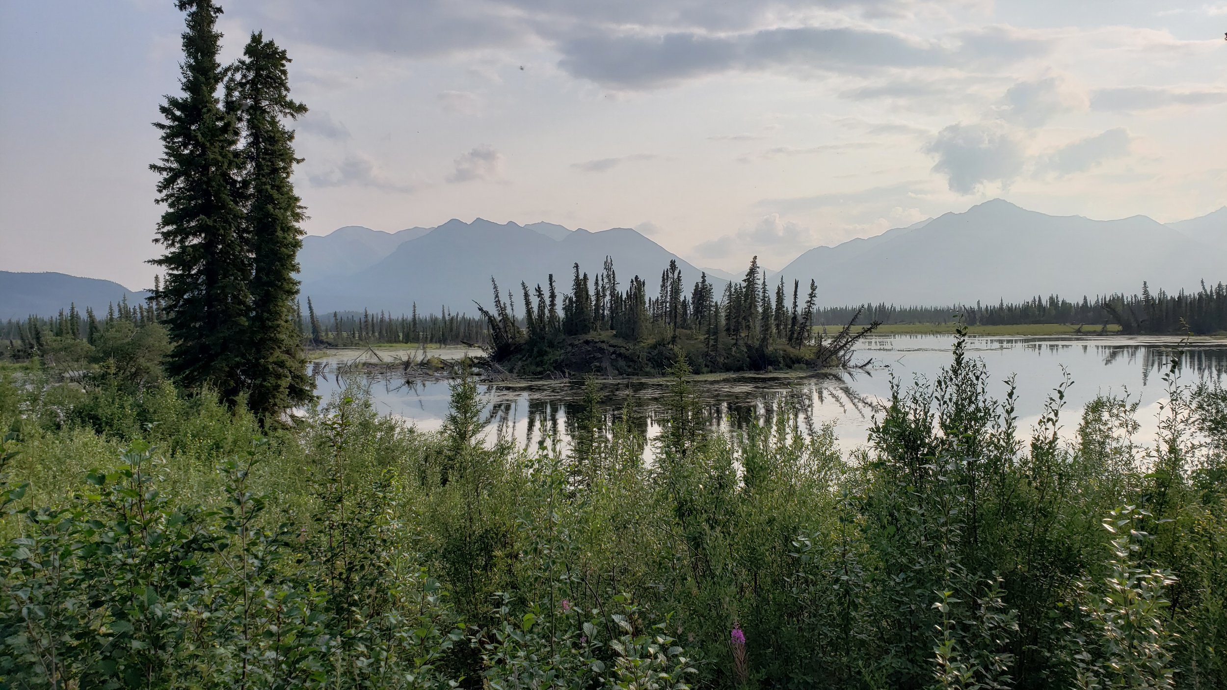
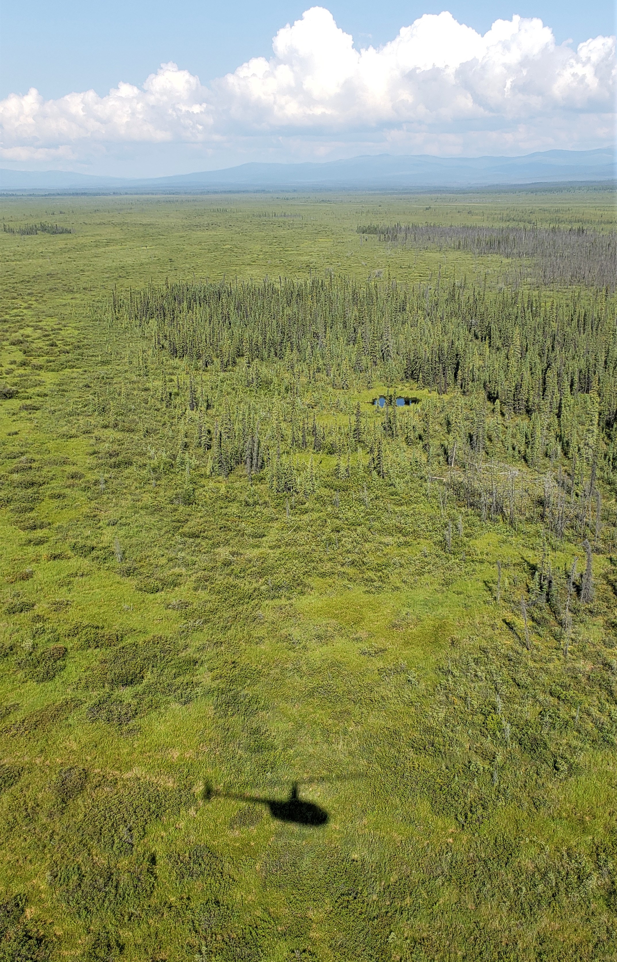
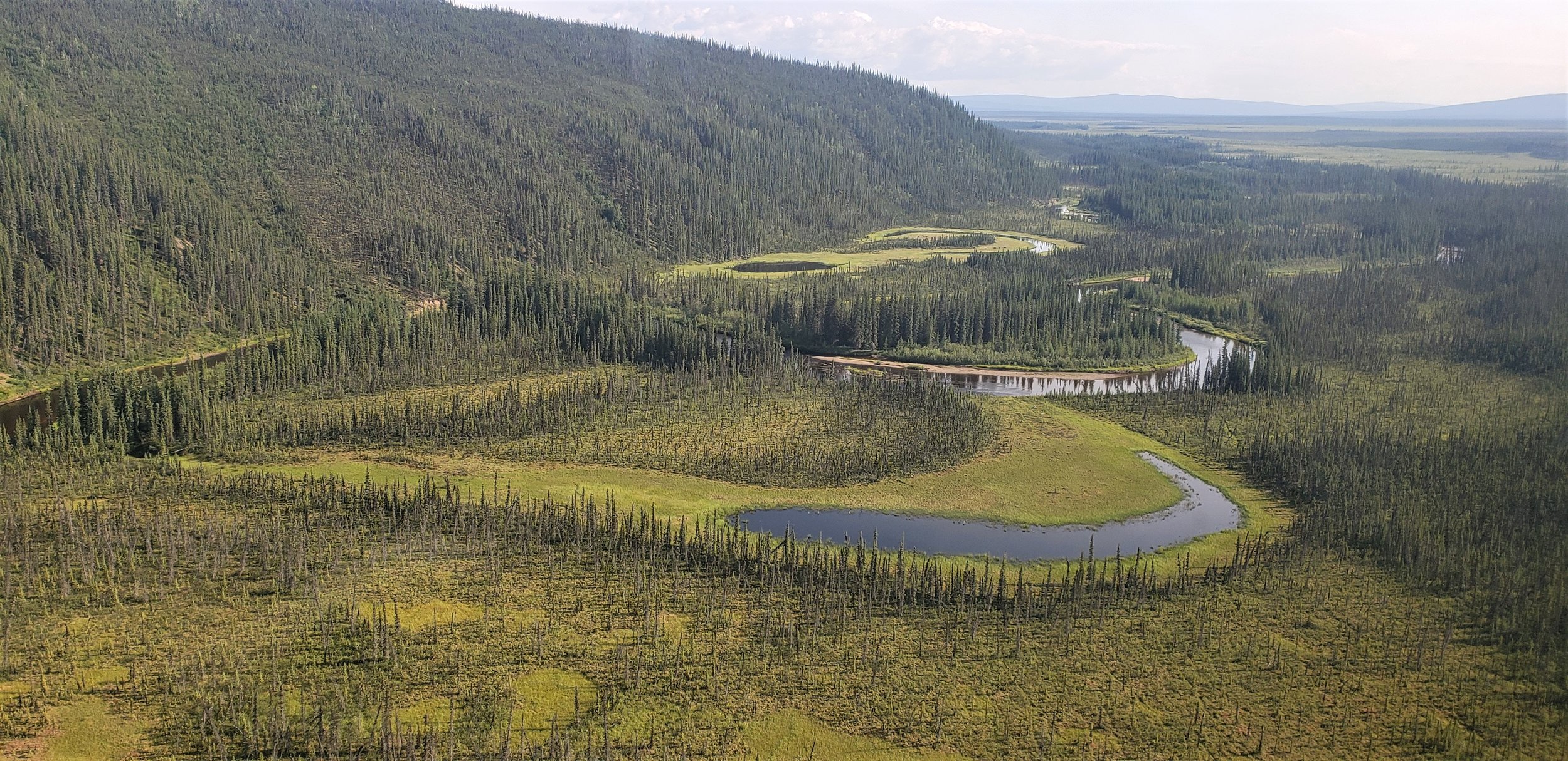
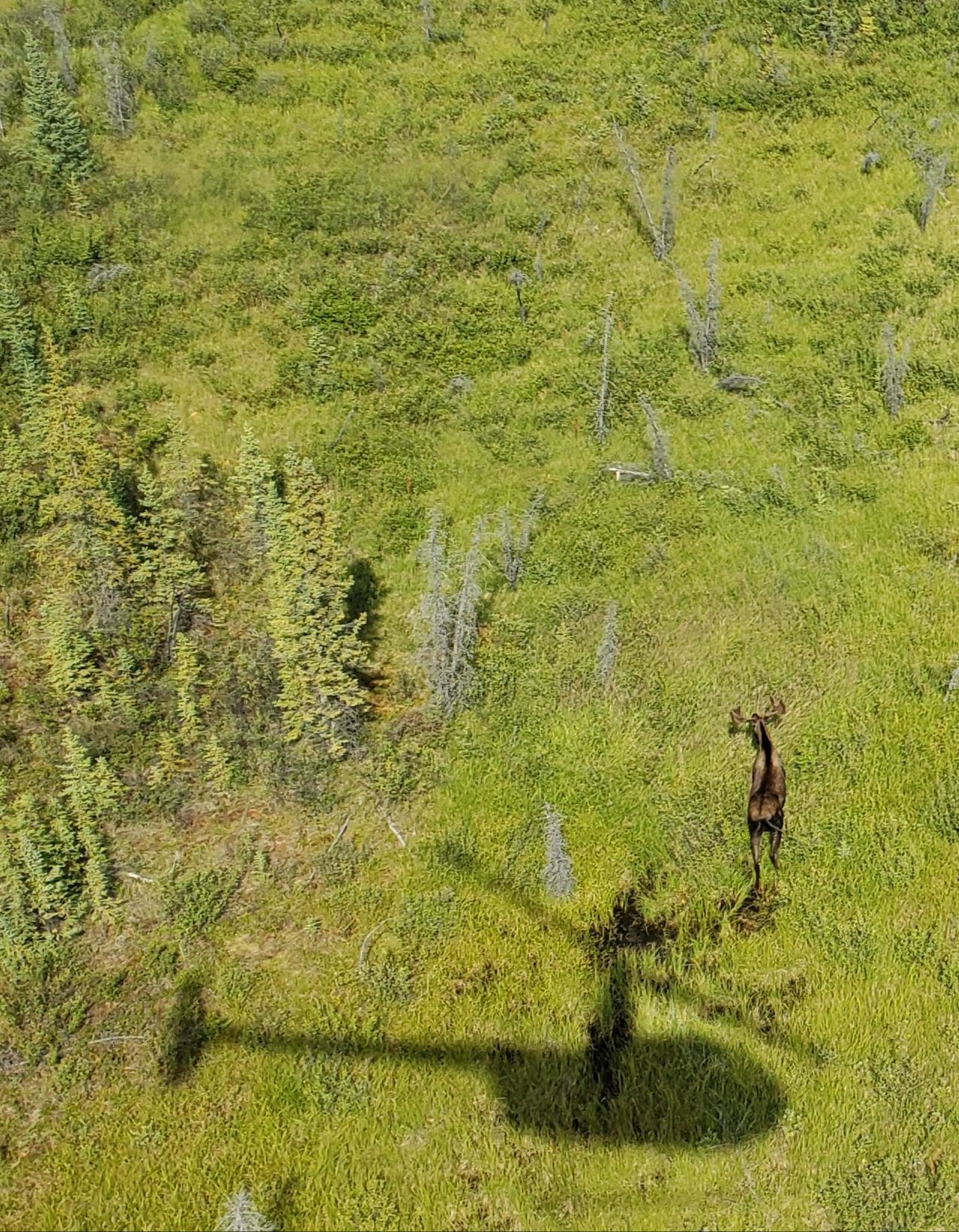
The BLM wetland mapping project and its fieldwork continued in July with GSS Staff members Kevin Stark and Eric Lindquist traveling to interior Alaska. This portion of the project covers around 6,000 square miles north of Tok, Alaska along the Canadian border to Eagle and west to nearly Delta Junction. The area primarily administered by the BLM is known to be vast, rugged and free of human development. A wide variety of wildlife was present and observed throughout the project area. The location is crisscrossed by many rivers and mountains with only one significant road, the Taylor Highway, bisecting the project area.
Alaska contains approximately 65% of the nation’s wetlands. In the current study area, wetlands are extensive and have not been mapped previously. This multi-part project will create data for use in further analyses, and provide others with data to track changes and plan as climate and resource extraction continue to be challenges in Alaska.
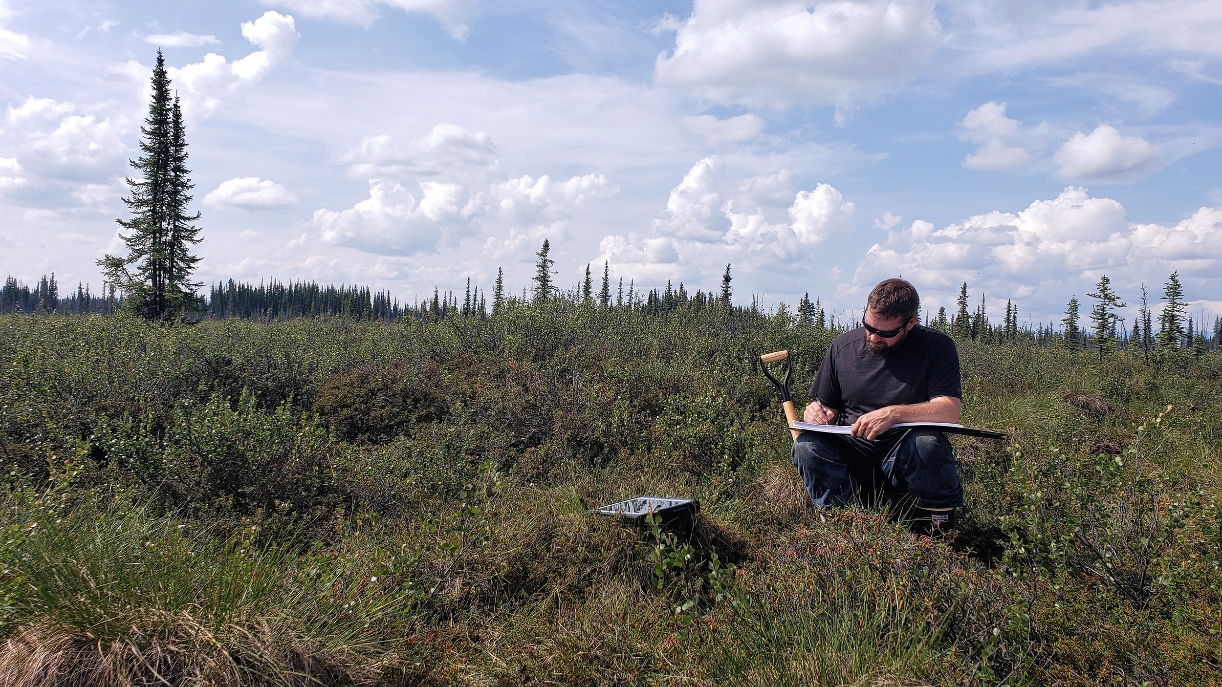
Eric and Kevin worked the area utilizing helicopter services out of Tok to familiarize themselves with the landscape and correlate satellite imagery, hydrology data, fire history data, and other collateral data with the landscape as observed from a helicopter and from select ground stops.. Vegetation, soils and hydrologic indicators of wetlands along with landscape positions were documented to inform the digital wetland mapping, a process which will be done over the next year or more. The correlation between trip observations and satellite imagery will be used to enhance the process of creating wetland data for the National Wetlands Inventory (NWI) program run by the United States Fish and Wildlife Service (USFWS). Kevin and Eric also met with USFWS staff to discuss findings and bring local knowledge and expertise to the project.